In any robust Landscape and Visual Impact Assessment (LVIA), the selection of viewpoints is not a procedural formality — it is an important part of the assessment process. Viewpoints are the spatial anchors from which potential visual effects are analysed and assessed. Their selection must therefore be considered, justifiable, and aligned with the methodology laid out in both GLVIA3 and its supporting Technical Guidance Notes, particularly LITGN 01/24 and TGN 06/19 on visual representation.
The purpose of viewpoints in LVIA
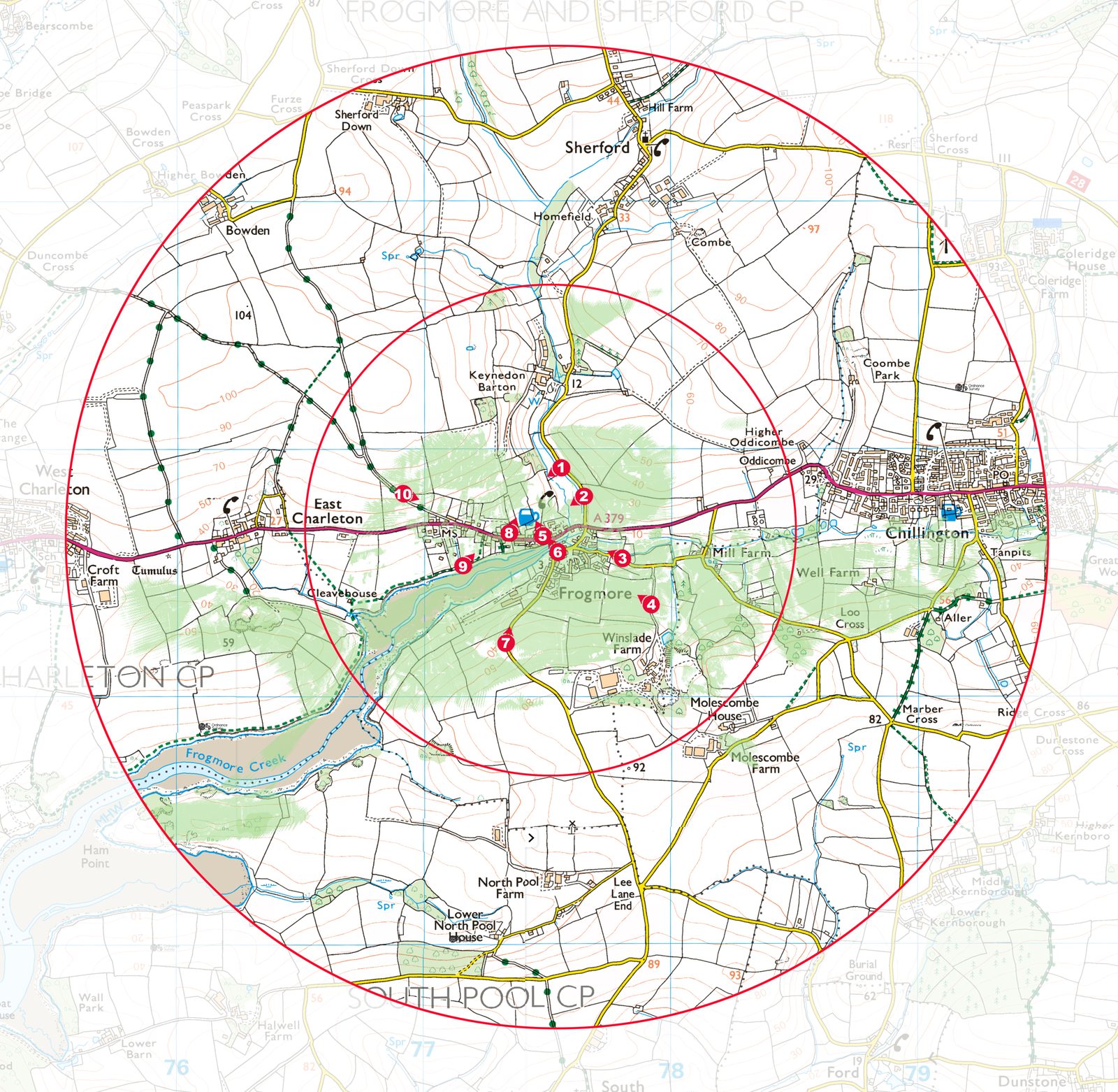
A viewpoint is a specific geographic location from which the proposed development will be visible — or from which the absence of visibility may be confirmed. It serves two primary purposes within the LVIA process:
- To support the assessment of visual effects on receptors, such as residents, walkers, road users, or heritage site visitors.
- To communicate likely change through visualisations such as wirelines, photomontages, or verified views.
Good viewpoint selection enables the LVIA to be both analytically thorough and visually communicative. Poor viewpoint selection — whether by omission or overgeneralisation — risks underplaying impacts or triggering objections during consultation or determination.
Types of viewpoints
GLVIA3 identifies several categories of viewpoint, each with a distinct role:
- Representative viewpoints: These typify the experience of a wider group of receptors in a given area (e.g. a long-distance footpath).
- Specific viewpoints: Focused on receptors of high sensitivity, such as a single dwelling or landmark.
- Illustrative viewpoints: Selected to demonstrate a particular feature or condition — such as a key ridgeline or opening.
- Worst-case viewpoints: Chosen to show the maximum potential visibility or greatest contrast with the existing landscape.
It is often appropriate to include a blend of these, depending on the scheme’s location, scale, and sensitivity.
Criteria for selecting viewpoints
Viewpoint selection must be purpose-led, proportionate, and based on a sound understanding of both landscape character and visual context. The process typically involves:
- Desk-based ZTV analysis (Zone of Theoretical Visibility) to model where the development is likely to be seen.
- Field verification to test ZTV predictions, especially where landform, built form or vegetation might block views.
- Consultation with the local planning authority, which may request or recommend specific viewpoints.
- Reference to public rights of way, residential areas, heritage assets, and designated landscapes.
Crucially, viewpoints must be accessible to the public, unless agreed otherwise for a particular purpose. The Landscape Institute’s TGN 06/19 also emphasises the need for reproducibility, meaning locations should be fixed using grid references or GPS coordinates and photographed with accurate metadata.
The role of planning officers and consultees
Best practice encourages early dialogue with the local planning authority to agree viewpoints, particularly where the development is likely to be contentious. Most authorities will expect the LVIA author to propose locations for their approval.
Failure to engage on this issue can result in additional information requests or resistance from consultees later in the process. Pre-application discussions are often the best time to finalise and justify the viewpoint strategy.
Need help on a specific project?
If you are working on a development that requires landscape and visual evidence, we can help. Tell us about your site and we will respond with a fixed fee and programme within one working day.