The brief
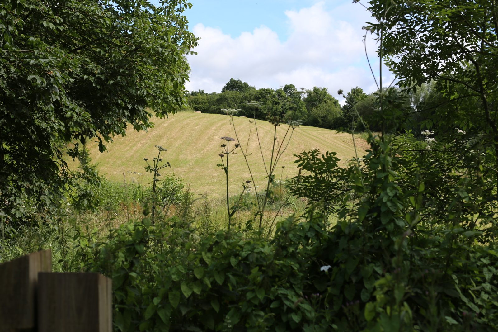
We were commissioned to prepare a Landscape and Visual Appraisal in support of a planning application for a new straw and hay storage barn, with an associated access track, on a working farm on the Herefordshire Plateau in Worcestershire. The site sits at around 104m AOD within the wide, ample valley of a small brook, with the surrounding landform rising to 210m AOD to the west and 230m AOD to the east — a classic Principal Timbered Farmlands setting of irregular hedge-bounded fields, scattered hedgerow oaks and small woodland blocks.
The barn itself is deliberately modest: 25m long, 6m wide and 4.7m to the ridge, framed in timber with a weathered, uncoated finish that will silver to grey over time, an apex roof, an open south elevation and further openings on the east. The proposed access track meanders along an existing stream on the eastern side of the plot before rising up to meet the top of the bank where the barn sits, minimising cut-and-fill and avoiding any straight-line incision into the field pattern.
The landscape and visual context
At the national scale the site lies within NCA 101 Herefordshire Plateau — a deeply tranquil, sparsely populated rural character area that has largely escaped modern development pressures and retains its dispersed historic settlement of farmsteads, isolated churches and small manor houses, linked by a network of narrow, often deeply sunken lanes. The Malvern Hills National Landscape extends into the wider NCA. Locally the site sits within the Principal Timbered Farmlands landscape type as defined in the Worcestershire Character Assessment — a small-scale, complex landscape unified by the strong presence of tree cover, with mature hedgerow oaks, irregular woodland blocks, organic field patterns and an essentially intimate, filtered character.
Both the NCA and the local character type were assessed as high value and high sensitivity, reflecting the National Landscape proximity, the Special Area of Conservation, several SSSIs and the strong heritage and tranquillity context. The site itself, however, was assessed as medium sensitivity — not subject to specific landscape designations, and with a fabric (small sloping field, hedgerow boundaries, an existing farm context) that has some scope to absorb modest agricultural development. Six representative viewpoints were tested across the local PRoW network and lanes, with the site visit undertaken in early July on a clear summer day.
Our approach
The interesting feature of this commission was that the LVA could not be read in isolation from a wider land management strategy. The barn application is part of a programme by which two fields are being taken out of continuous arable wheat and into regenerative agriculture: the field containing the barn itself is being managed as a herbal lay pasture left long, and the adjacent field is being restored as a water meadow. This was not just a one-off built intervention to be assessed against a static baseline — it was a small piece of built infrastructure within a substantive ecological and landscape uplift, and the LVA needed to make that case clearly to the decision maker.
Mitigation and design response
Mitigation was already partly delivered before the LVA was prepared. A 10m screening buffer along the northern boundary had been freshly planted, and further native tree planting was either in place or scheduled imminently along the western boundary. The barn’s low ridge height, modest footprint, weathered timber finish and apex roof were all calibrated to read as agricultural vernacular. The meandering alignment of the access track — following the stream rather than cutting straight up the field — ensured the new infrastructure folded into the existing field pattern rather than imposing on it. Together with the wider regenerative agriculture programme, the mitigation strategy genuinely contributes to the landscape rather than simply offsetting harm.
The outcome
At the NCA 101 Herefordshire Plateau scale, the assessment concluded a negligible magnitude of change and a neutral effect at both Year 1 and Year 10 — the barn is too small and too localised to register against a character area defined at this scale. At the Principal Timbered Farmlands local character type, the same negligible magnitude and neutral finding applied at both Year 1 and Year 10. At site level, the effect was reported as moderate adverse at Year 1, reflecting the introduction of a new built form on a small sloping field, reducing to slight adverse by Year 10 as the recently established planting matured and the field began to express its new herbal lay character.
Visually, four of the six viewpoints returned neutral effects throughout. Only two close-range viewpoints — from a public right of way to the north-west and from the lane junction adjacent to the farm access — reported visible change: moderate adverse at Year 1 reducing to neutral by Year 10 from the first, and slight adverse at Year 1 reducing to neutral by Year 10 from the second. The conclusion supported a small, well-considered piece of agricultural infrastructure embedded within a wider regenerative agriculture programme that genuinely strengthens the field-pattern fabric and ecological value of this part of the Herefordshire Plateau.
Working on a similar project?
If you are preparing a planning application that needs landscape and visual evidence — from a single dwelling to a major EIA scheme — we can help. Tell us about your site and we will respond with a fixed fee and programme within one working day.