The brief
We were commissioned to prepare a Landscape and Visual Impact Assessment for a new neighbourhood foodstore on the northern edge of a Staffordshire village. The site comprises a single 1.4-hectare field of semi-improved grassland between a busy A-road to the west and a small river to the east, and the scheme proposes a 2,283 sq m store with associated access, car parking, servicing, soft landscaping and a new riverside footpath along the river corridor.
What gave this commission its unusual weight was the Screening Opinion. The local planning authority concluded under the EIA Regulations 2017 that although the site’s individual scale fell well below the indicative thresholds for significant urbanising effect, the proposal sat within a Zone of Influence already carrying a substantial cumulative load, and an Environmental Statement was required. The LVIA therefore had to do a job it does not often do: stand as the sole technical chapter of the ES, carrying the entire EIA case on landscape and visual grounds alone.
The landscape and visual context
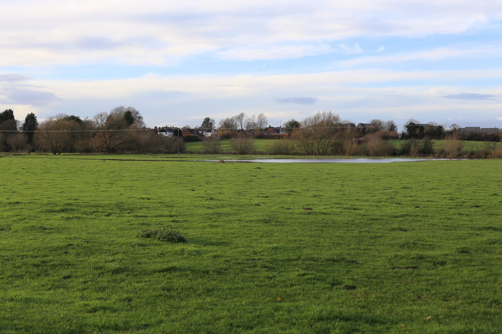
The site sits within NCA 61 Shropshire, Cheshire and Staffordshire Plain, and locally within an Ancient Clay Farmland Landscape Character Type. It is a gently rolling lowland of hedged fields, scattered oaks and the shallow, wooded valley of a small river, with the distant wooded ridge of a National Landscape rising several kilometres to the east. The relevant district-level Landscape Sensitivity Study places the site in an assessment area rated medium sensitivity, with a recognised capacity to absorb settlement-edge change.
Critically, the cumulative baseline was not hypothetical. A large residential scheme to the west was nearing completion, and a band of major consented or resolved-to-approve applications had begun to reshape the northern approach to the village: several large residential allocations along the A-road corridor, including schemes ranging from 135 to 750 dwellings, and a substantial employment scheme further north along the same trunk road. A band of new development was visibly emerging on both sides of the road.
Our approach
Fourteen representative viewpoints were chosen to test where the site genuinely mattered visually, and equally importantly to test it alongside each of the consented schemes within its Zone of Influence. Viewpoints from within the nearby National Landscape established that at elevated, high-sensitivity positions the site remained fully screened by intervening woodland and landform. The real story lay closer in: along the A-road, from the local rights-of-way network through the new residential development, from a side road across the river meadows and from the bridge on the edge of the village Conservation Area.
Mitigation and design response
The landscape mitigation strategy was pitched to reinforce, rather than replace, the existing rural structure. Existing mature hedgerows along the boundaries were to be retained and enhanced, with gappy sections reinstated in native species. New native hedgerow and tree planting was specified to the north-western boundary and internally to establish a green framework into which the store and car park would settle. A loose-surfaced riverside path and a buffer strip along the river preserved the site’s open interface with the river corridor, keeping the filtered rural outlook that most defined the place. Mitigation planting was to be delivered in the first available season following construction.
The outcome
At both NCA and LCA scale, effects were assessed as slight adverse at Year 1 and reducing to neutral by Year 10, not significant in EIA terms. At the site level, the magnitude of change was moderate at Year 1 (significant), reducing to slight adverse by Year 10 once the planting framework had matured. Only two viewpoints — one on the A-road and one across the river meadows — generated significant visual effects at Year 1, and both fell below the significance threshold by Year 10. Cumulatively, the assessment concluded that the foodstore consolidates, rather than extends, the emerging built edge of the village: it sits centrally within a belt of development that already includes large residential schemes to the north and west and further schemes to the east. That was the central finding the Council’s Screening Opinion had asked the ES to test, and it allowed the planning application to proceed on a clear, evidence-led landscape footing.
Working on a similar project?
If you are preparing a planning application that needs landscape and visual evidence — from a single dwelling to a major EIA scheme — we can help. Tell us about your site and we will respond with a fixed fee and programme within one working day.