The brief
The Landscape Workshop was commissioned to prepare a Landscape and Visual Appraisal in support of a planning application for a rear extension to Stanton Court — a Grade II* listed mid-18th-century country house, now in use as a care home, on the edge of a small village in the Chew Valley south of Bristol. The site sits within the Bristol Green Belt, within a village Conservation Area, and only a short distance from the famous Stone Circles — the third largest collection of prehistoric standing stones in England.
The proposal removes a previous rear extension and replaces it with a contemporary two-storey addition housing new bedrooms, a stair and lift, and day space areas for residents. The design deliberately moves away from the pastiche of the existing extension and adopts a more contemporary architectural language: a curved form that turns away from the main north elevation, a lower ground floor set into a sunken courtyard, soft timber cladding, modern glazing, and a green roof. The aim is to make a clear distinction between the historic house and the new structure so that each can be appreciated on its own merits.
The landscape and visual context
At the national scale the site sits within NCA 118 Bristol, Avon Valleys and Ridges, a landscape of alternating ridges and broad vales, with the Cotswolds and Mendip Hills National Landscapes flanking it to the east and south. Locally it falls within LCA 2b Chew Valley — the gently undulating valley of the River Chew, characterised by small hedge-bounded fields, well-wooded slopes, sunken lanes, and historic settlements clustered on the lower valley sides. Both character areas are assessed as high value and high sensitivity, reflecting the National Landscape designations, the SSSI and SPA status of Chew Valley Lake, and the strong concentration of conservation areas, listed buildings and Scheduled Monuments throughout the valley.
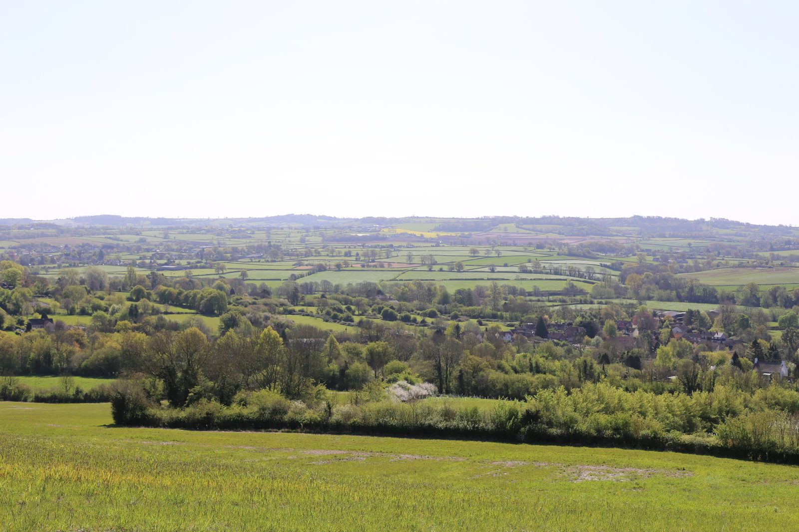
The visual baseline tested ten representative viewpoints across a 3km study radius, including positions on PRoWs north and west of the village, the Two Rivers Way long-distance path, byways and bridleways, the local B-road and lanes, the bridge over the river, and — most significantly — the elevated viewpoint from the Stone Circles themselves looking back towards the site. The site visit was undertaken in April on a clear day with good visibility.
Our approach
The defining feature of the assessment was visual containment. From every long-distance viewpoint — elevated PRoWs, the Two Rivers Way, the Stone Circles — the existing rear extension is hidden by the dense evergreen vegetation of the rear garden and the surrounding tree cover, and the new extension would be no more visible. The genuinely sensitive views were tightly concentrated: filtered glimpses from the bridge and the local road into the village, with limited additional visibility likely in winter months. We worked with the design team to keep the new extension at the same height as the existing structure, to set the lower-ground-floor element into the slope behind a sunken courtyard, and to wrap the addition with a curved north-facing facade that turns away from the main road approach.
Mitigation and design response
Mitigation centred on retention and reinforcement. The existing pattern of mature trees and shrubs around the rear garden — the very vegetation that contains the site visually — was to be kept in full, with new native tree and hedge planting along the northern and eastern boundaries to thicken the existing framework. The proposed design itself contributes to the mitigation: the green roof, the lower ground floor sunk into the landform, the curved geometry that hides the extension from the main road, and the soft timber cladding and modern glazing that allow the new structure to read as a calm, recessive intervention rather than a competing presence next to the listed house. Mitigation planting was scheduled for the first available season after construction.
The outcome
At the NCA 118 scale, effects were assessed as neutral at both Year 1 and Year 10 — the change is too small and too localised to register at the national character area level. At LCA 2b Chew Valley the same neutral finding applied at both stages. At site level, the development was reported as slight adverse at Year 1, reflecting the introduction of a new built form on a Grade II* listed setting, reducing to neutral by Year 10 once the reinforced planting had matured and the green roof had begun to read as part of the surrounding landscape pattern. Visually, eight of the ten viewpoints returned neutral effects throughout, with only the bridge and the local road reporting slight adverse effects at Year 1 reducing to neutral by Year 10. The Stone Circles viewpoint — the most culturally significant in the assessment — was assessed as neutral throughout, with the site fully screened by the rear garden vegetation. The conclusion supported a sensitive, contemporary intervention that respects both the listed building and the wider Chew Valley character. The proposal was subsequently approved.
Working on a similar project?
If you are preparing a planning application that needs landscape and visual evidence — from a single dwelling to a major EIA scheme — we can help. Tell us about your site and we will respond with a fixed fee and programme within one working day.