The brief
We were instructed to prepare a Landscape and Visual Impact Assessment for a proposed Battery Energy Storage System on land at Bowenhurst Farm, near Crondall in north-east Hampshire. The scheme comprised battery containers and associated infrastructure, a customer switchroom and store, a welfare building, CCTV poles, acoustic fencing, grasscrete access tracks, parking and SuDS basins and swales, all within a defined compound on two irregular fields at approximately 78m AOD.
The site sat in a sensitive but not undisturbed rural setting, and came forward alongside a cluster of other consented and emerging BESS schemes in the immediate area. The LVIA therefore had to do two jobs at once: demonstrate that this particular proposal could be accommodated at the site level, and reason carefully about how it would read in combination with neighbouring infrastructure.
The landscape and visual context
At the national scale the site lies within NCA 129 Thames Basin Heaths, a nationally significant landscape of Tertiary plateaux, woodland and heathland that is designated in places for its ecological importance. Locally it falls within Hampshire County Character Area 2C (Loddon Valley and Western Forest of Eversley) and, more specifically, Hart District's Dogmersfield LCA — a gently undulating, well-wooded patchwork of pastoral and arable fields, threaded by the Basingstoke Canal SSSI to the north and anchored by the historic parkland of Dogmersfield Park to the north-west.
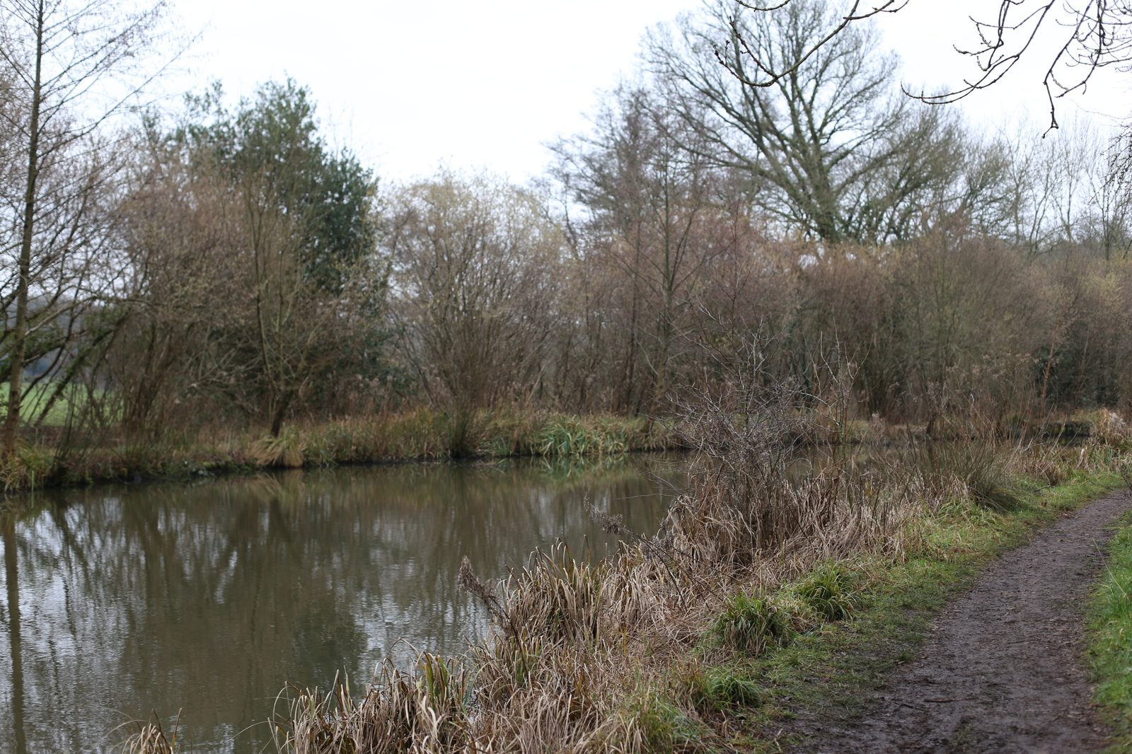
The immediate setting was notably less pristine than this description suggests. A large electricity substation at Coxmoor Wood, associated overhead power lines and a pylon standing within the site itself already introduced energy infrastructure as a recurring feature of the local scene. Key visual receptors were recreational: PRoW 061 11/1, the Basingstoke Canal towpath, byway 061 12/1, bridleway 178 73/1 and Mill Lane, together with properties along Rye Common Lane.
Our approach
Site survey and photography were carried out in February, representing winter visibility. We worked through ten representative viewpoints around the site, reading each in relation to intervening hedgerows, tree belts and the local landform, and drew a careful distinction between the intrinsic sensitivity of the Dogmersfield LCA (medium) and the lower sensitivity of this particular, infrastructure-influenced corner of it. A parallel cumulative assessment was prepared that addressed four consented or pending BESS schemes within the same Dogmersfield LCA — Rye Common Phase 1, Bluebell Lodge (Rye Common Phase 2), Ormersfield Farm and Land West of Crondall Road — to give the decision maker an honest picture of how the development would read as part of an emerging cluster rather than in isolation.
Mitigation and design response
The mitigation strategy started with retention. Existing hedgerows and scrub along the south, west and north of the site — the edges from which the scheme is most visible — were to be kept and managed to grow out, providing greater height and density. To reinforce this framework we specified native canopy trees (over 15m at maturity), small native trees (4–8m) and a low to mid-storey shrub layer (1–4m), together with semi-mature tree planting on the more exposed east and south edges where quicker screening would matter most. Wildflower grassland and SuDS basin and swale planting were introduced to lift the ecological value of the compound itself. Containers, the switchroom and ancillary structures were specified in recessive dark green and brown finishes to reduce contrast against the wooded backdrop.
The outcome
At the NCA scale the effects were reported as negligible and neutral at both Year 1 and Year 10. At the Dogmersfield LCA level, a low magnitude of change and a slight adverse effect at Year 1 reduced to negligible and neutral by Year 10 as the mitigation planting established. At the site itself — where hedgerow removal, levelling and the introduction of fencing created the most direct change — a medium magnitude and moderate adverse effect at Year 1 reduced to low and slight adverse by Year 10. Visual effects were generally neutral or slight adverse, with cumulative concerns concentrated on Viewpoints 7 and 8 on Rye Common Lane, where the proposal would read alongside the Rye Common consent. The assessment concluded that the scheme could be accommodated without significant or uncharacteristic harm, and supported a defensible planning case that engaged squarely with the cumulative picture rather than glossing over it.
Working on a similar project?
If you are preparing a planning application that needs landscape and visual evidence — from a single dwelling to a major EIA scheme — we can help. Tell us about your site and we will respond with a fixed fee and programme within one working day.