The brief
We were asked to prepare a Landscape and Visual Impact Assessment to accompany a retrospective planning application for a temporary change of use at a working farm in the Vale of Aylesbury. A parcel of land to the north of the farm's internal access road had been used for open commercial storage of HGV trailers and agricultural equipment, and our client was seeking consent for that B8 storage and distribution use on a time-limited basis, until 30th September 2026.
The retrospective and temporary nature of the application shaped how landscape and visual effects had to be reported. With the trailers already on the ground there was no conventional construction phase to assess, and with a fixed end date the assessment had to consider not only Year 1 but also a Year 2 snapshot with planting beginning to establish, and a Year 10 residual condition in which the temporary consent had lapsed and the site had returned to its original agricultural state.
The landscape and visual context
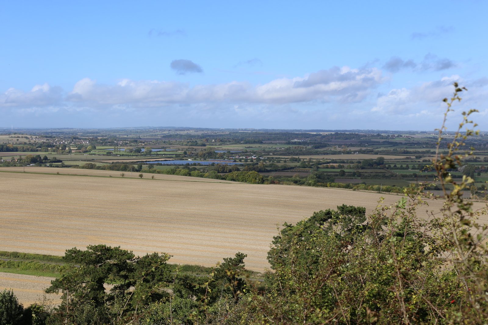
The site sits at 94m AOD in a gently undulating lowland landscape below the Chiltern Foothills, falling gradually into the flat Vale to the north. At the national scale it lies within NCA 88 Bedfordshire and Cambridgeshire Claylands, a sparsely populated claylands plateau dissected by shallow river valleys. Locally it falls within the Pitstone-Edlesborough Slopes (LCT 8), part of the Aylesbury Vale Landscape Character Assessment — an area of irregular field patterns and mixed land use that transitions between the foothills and the vale.
The Chilterns National Landscape lies 1.5km to the south-east, and that proximity raised the sensitivity of the wider setting. Closer in, the Grand Union Canal and its listed bridge and lock keeper's house ran past the farm, carrying a well-used towpath PRoW. Visual receptors tested included PRoWs IVI 5A/1, IVI 23/1, IVI 24/1 and CHD 6/1, motorists on the B488 bridge, and — most importantly — a high-level viewpoint from within the Chilterns National Landscape at 226m AOD looking back across the vale.
Our approach
Field work was undertaken in October on a clear day with good visibility. Because the site was in active use, we could assess actual rather than predicted visibility, reading each viewpoint against the trailers as they stood. A mature hedgerow along the south-east boundary was already taller than the trailers stored behind it, and we gave careful weight in the analysis to the extent to which that existing structure — together with farm buildings, bunds and canal-side vegetation — was already doing the job of containing views. Our sensitivity judgements distinguished clearly between the high baseline value of the canal corridor and the Chilterns panorama, and the lower sensitivity of a working farmyard already accommodating commercial-agricultural activity.
Mitigation and design response
The mitigation strategy was deliberately modest and tied to the temporary nature of the consent. Existing mature hedgerows, particularly along the south-east boundary, were to be retained and given space for maintenance and enhancement. We specified native hedgerow reinforcement and native tree planting along the boundaries surrounding the storage area, completed in the first available planting season. The key insight was that, because the trailers would be removed when the temporary permission expired, the planting would outlast the development — leaving a lasting positive legacy of thickened field boundaries and improved biodiversity after the site reverted to agricultural use.
The outcome
Effects on NCA 88 were reported as slight adverse at Years 1 and 2 and neutral by Year 10, reflecting the intensification of use at a scale that was small in proportion to the wider claylands. The same pattern was reported for the Pitstone-Edlesborough Slopes LCA. Visually, the most significant effects came from Viewpoints 1 and 6 on PRoW IVI 5A/1 and from Viewpoint 2 on the canal-side PRoW IVI 23/1, where the trailers registered as a slight adverse change at Year 1, reducing to neutral by Year 2 as planting began to screen the stored equipment. From Viewpoints 3, 4, 5 and the high-level Chilterns viewpoint the site was either invisible or formed such a minor component of a wide panorama that effects were neutral throughout. The assessment supported the temporary consent on the clear basis that the landscape impacts were limited, reversible and, thanks to the enduring hedgerow enhancement, would leave the site in a better condition than we found it.
Working on a similar project?
If you are preparing a planning application that needs landscape and visual evidence — from a single dwelling to a major EIA scheme — we can help. Tell us about your site and we will respond with a fixed fee and programme within one working day.