The brief
We were commissioned to prepare a Landscape and Visual Impact Assessment in support of a planning application for an L-shaped extension to an existing industrial unit at Wincanton Business Park in south-east Somerset. The host building sits on the south-western edge of Wincanton at around 75m AOD, adjacent to a concrete plant and the wider business park, with Hook Brook — a tributary of the River Cale — running along the western and southern edges of the application site.
The core challenge was a familiar one for edge-of-settlement industrial work: the site itself was of limited landscape sensitivity, but the wider rolling countryside to the west and north-west was not, and views back towards the Wincanton edge from elevated public rights of way needed careful treatment. The LVIA had to make the case that a further extension of the industrial footprint could sit comfortably within its context without eroding the qualities of the landscape beyond.
The landscape and visual context
At the national scale the site lies on the outer western edge of NCA 140 Yeovil Scarplands, a predominantly rural landscape of broad ridges, steep scarps and sheltered clay vales with a strong matrix of ancient hedgerows, woodlands and pastoral fields. Locally it falls within the Escarpment Ridges and Vales East of Yeovil character area and, more specifically, the Downland Combes and Holloways sub-area described in the Landscape of South Somerset assessment.
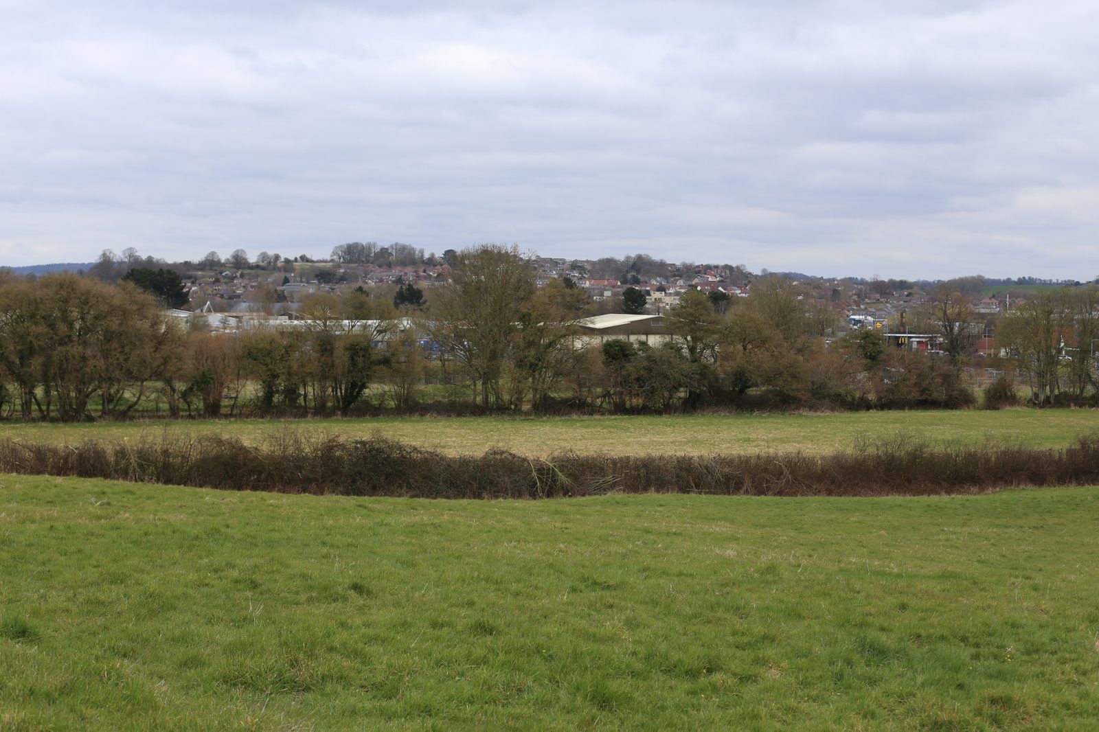
The immediate setting, however, was already firmly urban in flavour. The A303 passes just to the south, the A371 runs close by, and the site abuts Wincanton Business Park, Hopkins Concrete Plant and the Wincanton Gateway retail zone, with recent housing at Atkins Hill and Crocker Way stepping down from the north. The Peripheral Landscape Study of Wincanton had already classed the low-lying Hook Brook valley fields in this location as of low landscape sensitivity with high capacity for built development. Visual receptors ranged from elevated PRoWs at WN 30/6, WN 28/23 and WN 11/5 looking back over the town from 127–140m AOD, to close-range views from WN 30/50 and 30/50A along Hook Brook, and peripheral views from the B3145 and Long Close.
Our approach
Field survey and photography were carried out in March in good visibility, representing winter conditions when vegetation screening was at its weakest. We worked through eleven representative viewpoints, paying particular attention to the valley-floor position of the site and the degree to which the Hook Brook corridor — with its continuous band of mature oak, ash, hazel, hawthorn and blackthorn — was already filtering or breaking views of the existing unit. The assessment distinguished carefully between the high value of the wider NCA and local LCA and the much more fragmented, urban-fringe character of the site itself, which we rated as fair value, low susceptibility and low overall sensitivity.
Mitigation and design response
The design strategy centred on keeping the extension subservient to the host building in both scale and appearance. The proposed L-shaped extension does not exceed the height of the existing industrial structures and uses dark, non-reflective metal cladding to minimise contrast against the backdrop. New native hedgerow and tree planting was specified along Hook Brook and the site's boundaries, reinforcing the existing riparian corridor rather than competing with it — an approach calibrated to strengthen the ecological and visual structure of that corridor over time, so that the building would read as an increasingly integrated element within a thickening vegetated frame.
The outcome
Effects on the Yeovil Scarplands NCA were reported as negligible and neutral at both Year 1 and Year 10, reflecting the site's peripheral position relative to the defining scarps, vales and woodlands of the wider character area. At the Downland Combes and Holloways LCA level, a low magnitude and slight adverse effect at Year 1 reduced to negligible and neutral by Year 10 as the Hook Brook planting matured. Visually, effects were most pronounced from Viewpoints 9, 10 and 11 on the PRoWs immediately west of Hook Brook, where the extension was reported as moderate adverse at Year 1 reducing to slight adverse by Year 10. From the elevated Viewpoints 1, 2 and 3 and from Long Close, effects were slight adverse at Year 1 reducing to neutral by Year 10, and from the more distant rural viewpoints effects were neutral throughout. The assessment supported the planning case on the clear basis that the extension represented a minor intensification of an established industrial use, absorbed into a landscape already shaped by its urban edge, with no significant residual landscape or visual effects.
Working on a similar project?
If you are preparing a planning application that needs landscape and visual evidence — from a single dwelling to a major EIA scheme — we can help. Tell us about your site and we will respond with a fixed fee and programme within one working day.