The brief
We were appointed to prepare a full Landscape and Visual Impact Assessment for an outline application for six self-build and custom-build dwellings on the southern edge of a Warwickshire village. The application sought permission with all matters reserved except access and layout, with a new access road taken from the village road serving five plots to one side and a sixth plot at the northern end. A biodiversity enhancement area was proposed on the opposite side of the access road.
The complication here was designation. The site sits within a district-level Special Landscape Area under the local Core Strategy and is covered by a specific Neighbourhood Plan policy that protects the SLA and valued landscapes. Any LVIA needed to demonstrate not just technical acceptability but genuine sensitivity to the qualities that had earned the land its SLA status.
The landscape and visual context
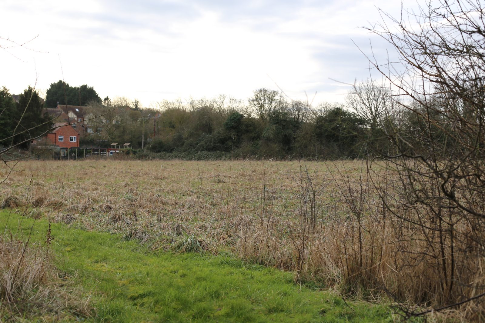
The site is a gently sloping field on the northern flank of a small hill, part of the fertile gravel terraces of the Warwickshire Avon Vale. It sits within NCA 96 Dunsmore and Feldon nationally, and at the local level within the overlapping Avon Valley — Upper Avon and Terrace Farmlands character areas identified in the district SPD and the county landscape guidelines. The character is one of large geometric fields on flat terraces, winding hedgerows with mature hedgerow trees, small nucleated villages in red brick, timber and Blue Lias limestone, and well-wooded stream lines. The field itself is enclosed to the north and east by existing housing on the edge of the village, with more open hedged field boundaries to the west and south.
The visual baseline covered ten viewpoints taken in January to represent the worst-case winter scenario, from the village road, a local lane, a bridleway and a suite of public footpaths. From the longer-range footpaths to the north and east the site is entirely screened by intervening landform, hedges and the existing village envelope. The decisive receptors sit much closer: a footpath threading between the existing houses and the play area where the field is fully visible, and a position on the village road itself where the site reads through a narrow gap at the edge of the built-up area.
Our approach
Because the site sits on the village edge rather than in open countryside, we framed the assessment around the transition zone. The existing hedgerow framework, mature boundary trees and the immediate adjacency to existing housing on three sides meant the proposals could reasonably be read as a rounding-off of the settlement rather than an intrusion into open farmland. We used the closer viewpoints to test honestly how prominent the dwellings would be at Year 1 before any planting had established, and the more distant PRoW receptors to demonstrate how contained the site is within the wider Upper Avon landscape.
Mitigation and design response
Mitigation focused on retention, reinforcement and the biodiversity enhancement area. The existing mature boundary hedgerows were to be retained in full, with sufficient space left for their long-term management and enhancement. New native tree, hedge and shrub planting was recommended within the development itself, including along one side of the new access road, to bind the dwellings into the existing hedge network. The biodiversity enhancement area was designed to deliver ecological uplift while also softening the transition from built form to open farmland. Planting was to be implemented in the first available season after construction so that establishment could start immediately.
The outcome
At the NCA 96 scale the predicted effect was slight adverse at Year 1, reducing to neutral by Year 10 as mitigation matured. Within the local character area the effect followed the same pattern — slight adverse initially, reducing to neutral — with the development reading as a natural extension of the village’s settlement edge rather than an isolated intervention. Site-level effects were reported as moderate adverse at Year 1, reducing to slight adverse at Year 10. Visually, the highest impacts came from the village road and the adjacent public footpath where initial effects were moderate adverse, reducing to slight adverse as planting established; from the wider PRoW network effects were predominantly neutral throughout. The report concluded that, with sensitive design and the proposed landscaping strategy, the six dwellings could be absorbed into the edge of the village without material harm to the Special Landscape Area. The scheme was subsequently granted permission on appeal.
Working on a similar project?
If you are preparing a planning application that needs landscape and visual evidence — from a single dwelling to a major EIA scheme — we can help. Tell us about your site and we will respond with a fixed fee and programme within one working day.