The brief
We were commissioned to prepare a Landscape and Visual Impact Assessment supporting a planning application for a new solar farm in Nottinghamshire. The site sits on a low local hill and is split into two parcels at around 147m and 150m AOD, both immediately south of a busy A-road regeneration corridor. The scheme comprised rows of fixed-orientation photovoltaic panels approximately 2.9m high at the rear, spaced 2.5m apart and set at a 25-degree tilt, aligned east to west in a coherent linear layout. Each parcel would be secured by 2m post-supported fencing, with access tracks, transformer stations, a DNO substation, a customer substation and a store room located along the northern edge of one parcel and the south-eastern edge of the other.
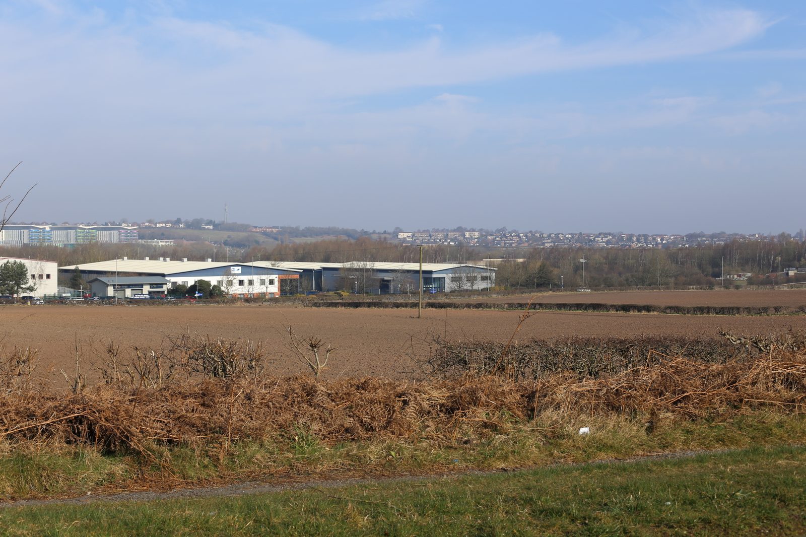
The landscape and visual context
At the national level the site sits within NCA 49 Sherwood, a gently rolling sandstone landscape historically characterised by woodland, heathland, open arable farmland, mining heritage and large estate parklands. At the local level, the relevant landscape character assessment places the site within a Wooded Farmlands character area defined by gently undulating arable fields, tall mixed hedgerows, pasture, a nearby reservoir and the strong influence of the A-road corridor and surrounding industrial estates. The hill itself is a Scheduled Monument, and there is an existing solar farm of comparable scale already operational nearby — an important reference point for the character baseline.
The immediate context is heavily conditioned by infrastructure. The A-road bounds the northern edge, a large business park with warehouses and commercial units lies just beyond, and built-up areas press in from the north and west. Land cover within both parcels is predominantly open arable with sparse, fragmented hedgerows. Twelve viewpoints were assessed including bridleways, parkland and reservoir footpaths, and a series of vehicular and roadside positions. From the higher-sensitivity recreational receptors — the reservoir footpath, parkland footpaths and bridleway — the site is effectively screened by landform, vegetation and the built edge. The closer vehicular and roadside receptors pick up the most direct views, with one parcel fully visible from two viewpoints and the other glimpsed through roadside vegetation from three more.
Our approach
Solar farms bring a particular set of landscape issues: the extent of low-level built form, the visibility of security fencing, the legibility of the panel rows, the concern over reflectivity and glint, and the need to demonstrate that ecological gains along field margins are genuine rather than cosmetic. We tackled each explicitly. The panels specified for the scheme were matt, non-reflective photovoltaic modules designed to absorb rather than reflect light, and we noted the recessive colour palette and self-finishing materials in the assessment. We leaned on the existing industrial and transport influences to demonstrate that an additional solar land use represented an intensification of an already modified landscape rather than a new departure, and we used the existing solar farm nearby as evidence of cumulative fit.
Mitigation and design response
Mitigation was built around the hedgerow network. All existing field boundary hedgerows were to be managed and reinforced to approximately 3.5m in height with an A-shaped profile to maximise both screening and ecological value, with any hedgerows already taller than 3.5m retained at their existing height under less-intensive management for ecological benefit. Native reinforcement planting was specified to fill gaps. Offsets from field boundary vegetation were designed to protect Root Protection Zones and provide a generous maintenance buffer, with an additional 1m offset from Category A trees. Panels were laid out to retain the existing field structure, and the perimeter hedgerow enhancements were designed to double as biodiversity margins, linking into the wider mosaic of habitats within the local character area.
The outcome
At the NCA scale the assessment concluded a negligible magnitude of change and a neutral effect at both Year 1 and Year 10, on the basis that the scheme would not constitute a fundamental departure from the already-modified Sherwood landscape. Within the local Wooded Farmlands character area the effect was reported as slight adverse at Year 1, remaining slight adverse at Year 10. Site-level effects were moderate adverse at Year 1, reducing to slight adverse at Year 10 as the reinforced hedgerow structure established. Visually, the recreational receptors around the reservoir, bridleway and parkland footpaths saw no material change; the roadside viewpoints saw slight to moderate adverse effects at Year 1, reducing to slight adverse or neutral by Year 10 as hedgerow management took effect. The appraisal supported the application by demonstrating that the proposal sat comfortably within the existing infrastructural and industrial grain of the landscape and that, with the hedgerow-led mitigation strategy, long-term residual effects would be modest and broadly acceptable.
Working on a similar project?
If you are preparing a planning application that needs landscape and visual evidence — from a single dwelling to a major EIA scheme — we can help. Tell us about your site and we will respond with a fixed fee and programme within one working day.