The brief
Our client was a local village football club seeking planning permission for a new LED floodlighting system at their existing ground on Bassett Road, Letcombe Regis, just south of Wantage in Oxfordshire. The proposal was modest in scale but sensitive in context: the ground sits within the North Wessex Downs National Landscape, approximately 100m from the Letcombe Regis Conservation Area and its cluster of listed buildings. Any LVIA would need to work not only with the usual landscape character questions but also with night-time visibility, light spill, sky glow and the risk of introducing an incongruous new vertical element into a highly valued rural setting.
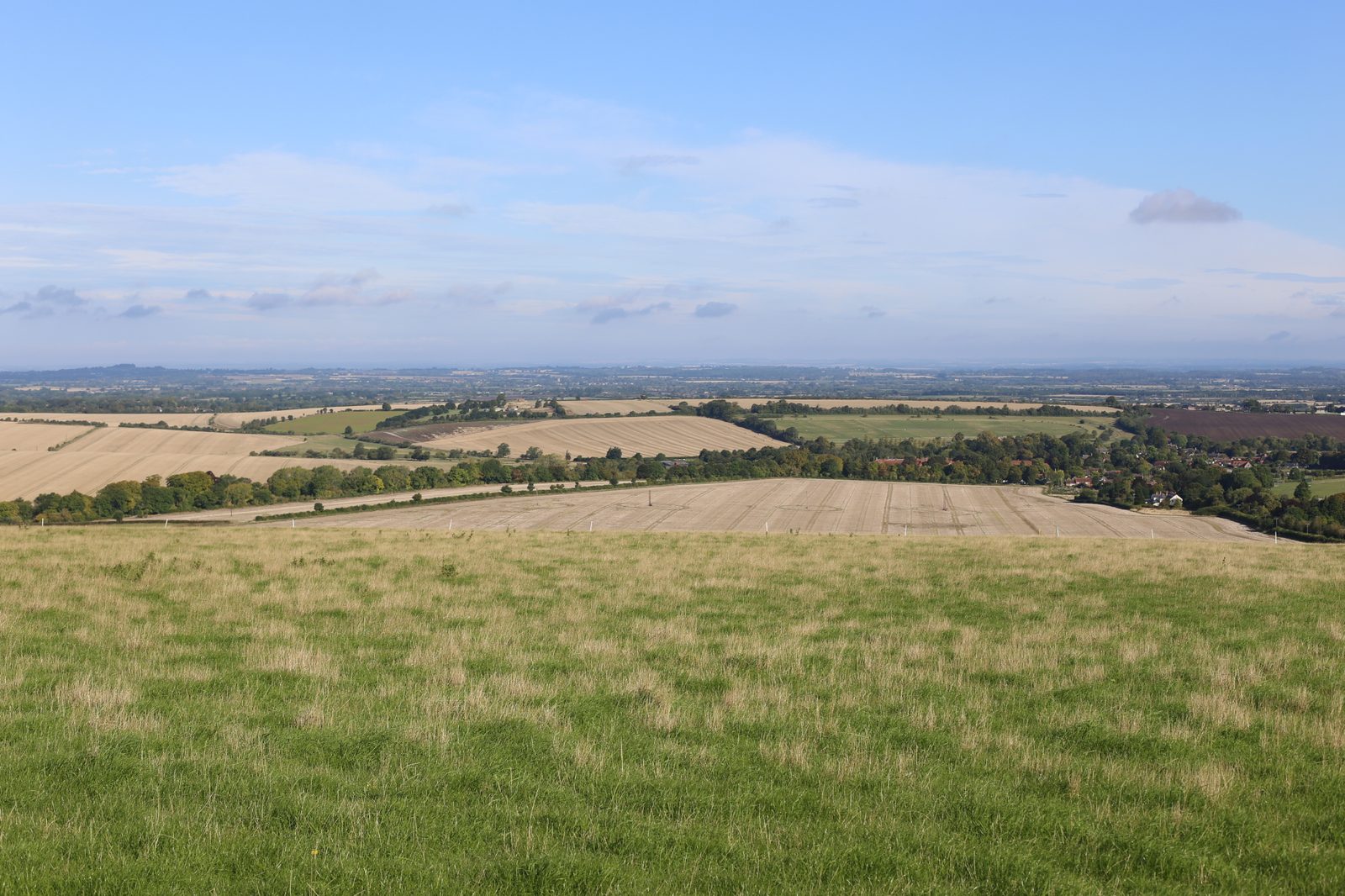
The landscape and visual context
The football ground is a grassed pitch at around 102m AOD, enclosed by perimeter hedgerows with mature boundary trees and a semi-circle of deciduous trees around the adjacent recreational lawn. It sits at the foot of the dramatic Idstone to Chilton Downs Scarp, with the Ridgeway National Trail running east-west along the top of the ridge to the south. Nationally the site falls within NCA 116 Berkshire and Marlborough Downs; locally it sits within LCA 5 Downs Plain and Scarp (5C Hendred Plain) as defined in the North Wessex Downs Management Plan, and within the Vale of White Horse Landscape Character Area FS2 Seven Acre Hill to Round Hill Downs Footslopes. The character is one of undulating chalk footslopes, vast arable fields, long panoramic views to the scarp, historic nucleated villages along Letcombe Brook and a strong sense of tranquillity and dark skies.
The visual baseline covered eleven viewpoints from the surrounding PRoW network, including Byway 339 10/10, Restricted Byway 275 11/10 at Letcombe Castle, The Ridgeway National Trail itself, Byway 275 3/10 at the edge of the Conservation Area, Bridleway 274 11/10, Letcombe Village Hall grounds, Basset Road adjacent to listed cottages, Court Hill Road and PRoW 275 2/20. From most of these the ground reads as a discrete recreational enclave, screened or filtered by boundary hedges and mature trees, with the village of Letcombe Regis and the scarp providing the backdrop. The key question was therefore not daytime visibility of the columns but how the lit element would behave on winter evenings against an otherwise dark rural skyline.
Our approach
We focused the assessment on the specific sensitivities that floodlighting raises in a National Landscape: the introduction of vertical lighting columns into an otherwise horizontal rural scene, night-time sky glow and light spill, the potential erosion of dark-sky character, and the effect on tranquillity for users of The Ridgeway and the wider PRoW network. The operational regime was central. The club's proposed use pattern — a maximum of four hours per week, restricted to the darker winter months — meant impacts would be intermittent and seasonally bounded, a point we made explicit in the assessment to keep the reader grounded in the realistic worst case.
Mitigation and design response
The mitigation package was built directly into the lighting design. Sky glow was to be controlled through appropriately shielded luminaires, with optics tuned to restrict the distribution of light, prevent upward spill and minimise glare beyond the pitch. Columns were specified in a dark recessive finish so that, by day, they would read against the surrounding tree canopy rather than stand out against the sky. The number of columns was reduced to the operational minimum. Operating hours were to be strictly limited. Existing boundary hedgerows and mature perimeter trees were to be fully retained, with scope identified for further native tree planting if additional softening proved necessary over time.
The outcome
At the NCA 116 scale the appraisal concluded a low magnitude of change and a slight adverse effect, given the small and localised nature of the intervention. The same slight adverse effect was reported at the level of LCA FS2 Seven Acre Hill to Round Hill Downs Footslopes, with the assessment noting that the floodlighting would not alter landform or boundary vegetation and that the existing village context already carried some level of artificial lighting. Visually, most viewpoints came out as slight adverse, with the masts reading as part of the tree canopy by day and the lit condition sitting within the context of Letcombe Regis' existing light spill at night. Moderate adverse effects were identified only at viewpoints 3 and 4, where the low angle and the absence of other lighting in the foreground made the lit columns more prominent — and even then only during the limited winter operating window. The appraisal concluded that, with the directional optics, dark column finish, reduced number of columns, controlled hours and the inherent reversibility of the installation, the scheme would not be detrimental to the landscape or visual character of the North Wessex Downs National Landscape.
Working on a similar project?
If you are preparing a planning application that needs landscape and visual evidence — from a single dwelling to a major EIA scheme — we can help. Tell us about your site and we will respond with a fixed fee and programme within one working day.